|
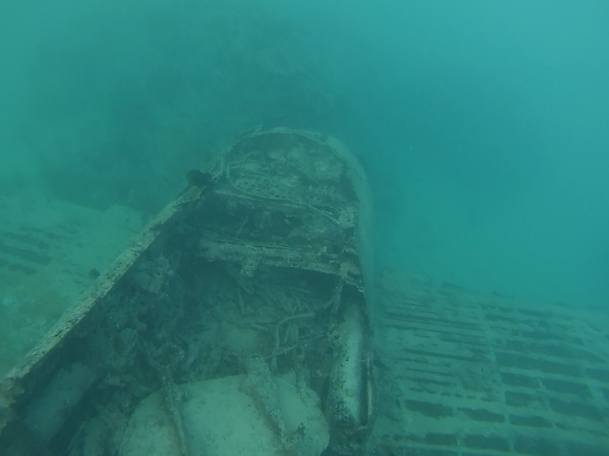
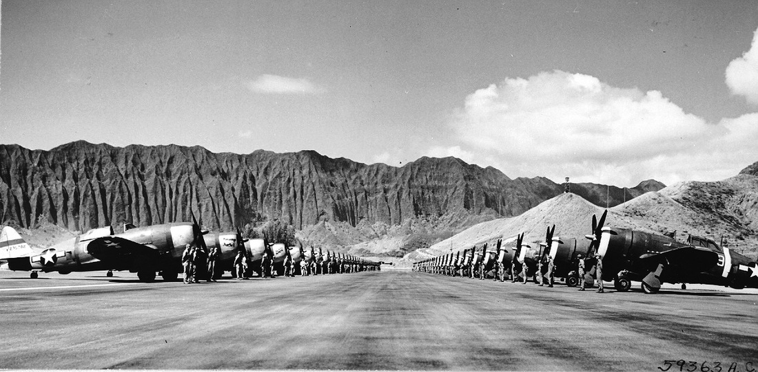
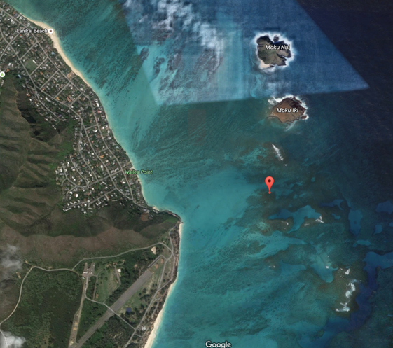
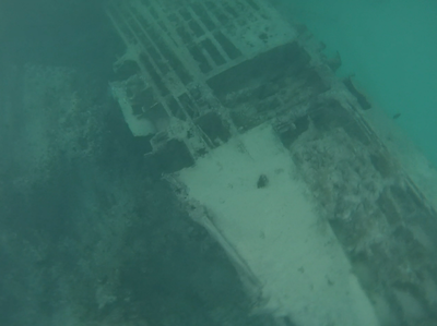
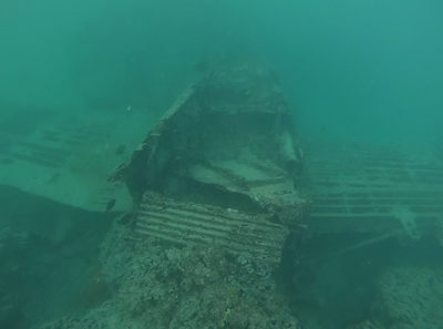
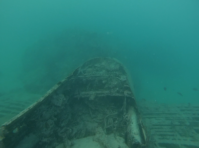
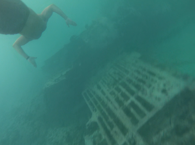
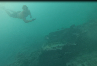
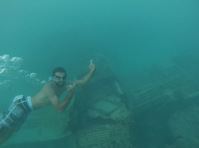
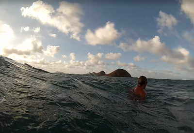
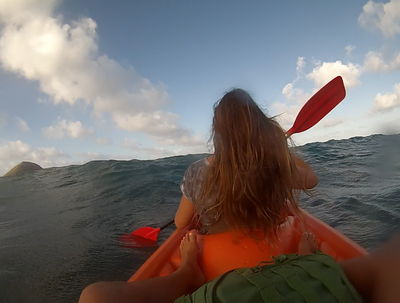
On June 21, 1944, 1st Lt. William Sparks took off in his P-47 Thunderbolt from Bellows Air Field at 3:33 P.M. only to experience immediate engine failure in the famously heavy fighter-bomber nicknamed the 'Jug', which would force the young officer to crash land some 1,000 yards offshore on the shallow reef located to the south west of Moku Iki island. According to excellent research conducted and recorded in 'A World War Two Underwater Plane Wreck: The History of a P-47' by Whitney Petrey, et al., 1st Lt. Sparks was uninjured in the crash and was able to walk and swim back to base. Incredibly, Petrey goes on to detail a second crash involving Officer Sparks whereon March 4, 1944 - only a mere 3 and a half months prior to the Lanikai crash -the young pilot collided in mid-air with 2nd Lt. Lloyd R. Millet at 6:12 p.m. over Oahu. Millet bailed out and sustained minor injuries. Sparks crash landed without injury. What's more, the very same P-47 Sparks crash landed on June 21st in the reef off windward Oahu had previously crashed at a Municipal Airport in New Mexico. Some plane...some pilot! P-47 Thunderbolts at Bellows Field, Oahu, 1944. Source: United States Army via Hawaii Aviation Preservation Socciety (Licensing: Public Domain under United States Code, Title 17, Chapter 1, Section 105). Image was found here, posted by David Stubblebine, on ww2db.com. The more I learned about the story, the more obsessed I became, and after carefully studying satellite imagery and reading everything available on the subject of the crash, I set my sights on finding the wreckage and exploring it as soon as possible. With a first-rate 'boat crew' in Hans and Kass, and a borrowed kayak from local shark researcher, Derek Kraft, our three person team set out at 5:30 p.m. on 5/23/16 (other commitments delayed our departure) from the end of the beach access at Lanipo Street in heavy onshore wind swell and rough surface chop. Incredibly, Hans volunteered to swim out to the crash site, allowing Kass and I to navigate for him from our elevated position in the borrowed kayak, while he would provide reef reconnaissance through his goggles while swimming alongside of us. We made our way due south along the shore to the rock marking the No-Pass Zone at the beginning of Bellows Air Force Station. From here we would work our way directly out to sea, aiming to the South and slight West of Moku Iki Island. We located the reef-less deeper channel we had studied in our satellite imagery and worked our way further out to sea fighting increasingly large wind swell and chop - the waves increasing at times to 3+ feet requiring constant vigilance, effort, and nuanced paddling to avoid capsizing, which could have proven catastrophic given the likelihood that we wouldn't be able to get back to the boat should it become separated from us. We are all expert ocean swimmers with a great deal of experience in this exact area, but still did not want to court extra danger of any kind given the area's dangerously shallow reefs at the edge of the shelf, the late hour of the day, the large swell, and the potential presence of aggressive marine life. We toiled to hold our position in the expected location of the crash while Hans furiously searched the reef for the wreckage. From the boat we continued to triangulate off of Moku Iki and the end of the runway's coastal position and angle, the coral and break waters around us, and our relative position to the channel, all while trying to maintain proper alignment to the oncoming surf, off of - and away from - massive coral heads, and close enough to Hans to provide assistance should any prove necessary. After nearly an hour, we were about to have to abandon the effort and return to shore with what little daylight remained when Hans announced that the wreck was directly below him!!! We took turns manning the boat (no easy task!) while the other two explored the wreckage in the ever-darkening waters. [Side note: While some might wonder why we chose not to anchor, the answer is simple...WE DID NOT WANT TO RISK DAMAGING THE WRECK IN ANY WAY NOR THE SURROUNDING CORAL. If you visit the site, PLEASE do not touch the plane, surrounding coral, or anchor anywhere near the plane where the to-be-expected heavy surf is likely to shift your anchor and possibly cause damage to this amazing artifact. Consider and practice your strategies ahead of time to avoid having to rely on less than ideal practices.] The wreckage was both eerie and magnificent at the same time. After exploring the fuselage, cockpit, and wings for several minutes each, it was time to head rapidly for shore to avoid having to make our escape back to land in the dark. We were thrilled to have found this absolute gem given that many people we have talked to have tried in some cases numerous times and been unable to locate the wreckage in the heavy surf, maze of coral, and due to the difficulty of seeing the plane from the surface. Without Hans' determination to swim through those rough conditions we surely would have missed it. An incredible adventure and surely an evening none of us will ever forget! A screenshot from Google Maps indicating the location of crash site is below. The GPS coordinates can be found here. Disclaimer: This adventure should only be attempted by highly experienced open ocean kayakers and swimmers. This is a very dangerous area in the ocean and familiarity with the local currents, swells, wind conditions, and tides is critical to a safe and successful journey. 'HOA' accepts no liability of any kind in the event you choose to try to locate the wreck. You and you alone are responsible for your safety. Check with the local kayak rental places, NOAA, and other wind and weather related sources before heading out. Be safe, have fun, and remember not to touch or otherwise damage the wreckage or surrounding coral. We'd also suggest only attempting this adventure in clear, calm, flat conditions. Mahalo!
11 Comments
|
Archives
April 2020
Categories
All
|

 RSS Feed
